Research Direction
Improving our understanding of mountain snowpack dynamics across scale.
My research aims to improve our understanding of mountain snowpack dynamics and develop better model representations of snow water resources in complex terrain. Currently, I am most interested in developing downscaling techniques for global SWE products.
Current Project
Modeling SWE at continental scales
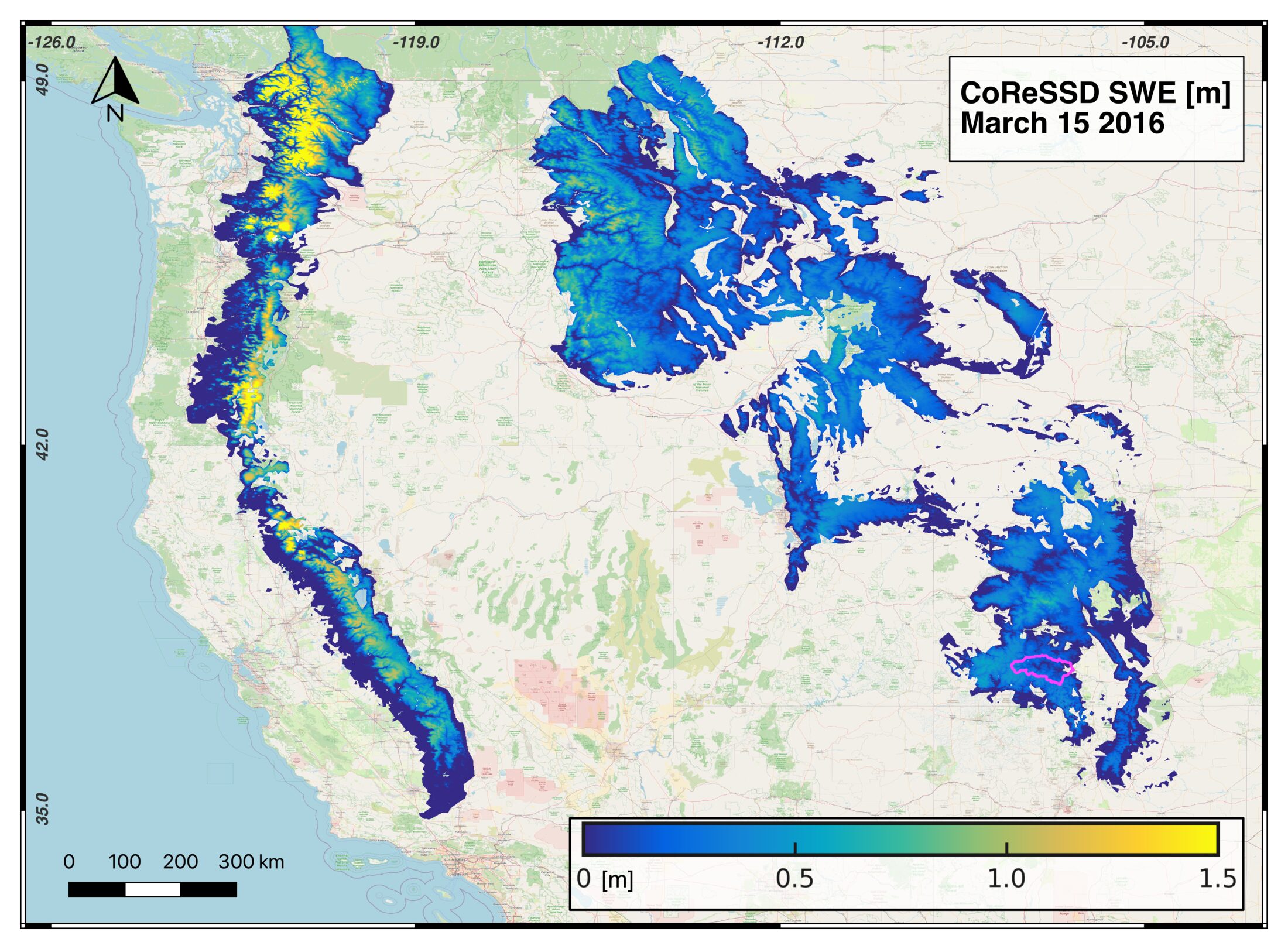
The Cold Regions Snowfall and Snowpack Dataset (CoReSSD) is a 1 km snowfall and snow water equivalent dataset spanning North America above 30°N for water years 2001-2021. This dataset was produced with funding from NASA Grant #80NSSC22K0585. CoReSSD relies on the Blender algorithm (Dechow et al., 2026, Water Resources Research), a non-linear optimization technique that recomputes the modeled mass and energy balance of the snowpack while being constrained by remotely sensed snow cover fraction.
I was involved in the development and testing of the Blender algorithm during my PhD at Ohio State University and continued that work during my postdoc at UNC. At UNC, I helped update the algorithm to run more efficiently over large domains, developed the precipitation scaling technique used to improve spatial variability in the prior dataset, and oversaw production of the full dataset.
Research Highlight
CoReSSD: a 1 km North American SWE dataset
Initial validation against the Western U.S. Snow Reanalysis (WUS; Fang et al., 2022) shows CoReSSD substantially outperforms both the NoahMP prior (R = 0.71, RMSE = 83.1 mm) and ERA5-Land (R = 0.63, RMSE = 90.9 mm), achieving R = 0.89 and RMSE = 56.2 mm in the test basin.
Full validation across the 20-year record is ongoing and is being prepared for submission to Earth System Science Data.
Interdisciplinary Application
Snow modeling beyond hydrology
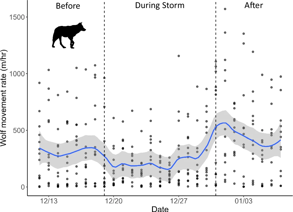
In December 2021, an atmospheric river dropped a 300-year precipitation event on interior Alaska, more than 7 SD above the 99-year mean at Denali National Park. Using snow pit surveys across forest, shrub, and tundra sites, we found that ice thickness within the snowpack varied dramatically by vegetation type, and caribou shifted to higher elevations to find accessible forage.
These results suggest that topographic and habitat diversity in mountainous ecosystems may buffer wildlife populations against even extreme winter weather events. I contributed the land surface and passive microwave snow modeling used to characterize the spatial extent and intensity of the rain-on-snow event across the park.